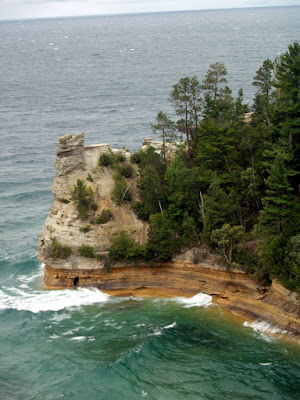
The Pictured Rocks are 15 miles of sandstone cliffs between Munising and Grand Marais. The waters of Lake Superior have shaped the cliffs in to various formations include the castle, a Indian Chief's head and more. At the same time, water is continually leaching out between the sandstone layers. In the winter, the water freezes and sometimes sections of the cliffs will break off and fall in the water. This happened to the Grand Arch in 2000 and to Miner's Castle in 2006.
If you read my previous post, you know that is was cold and rainy. When I arrived at the parking area for the overlook, it wasn't raining. There is a short walk to the platform that looks down towards Miner's Castle. Its still cold but not so bad with my coat on. Until I step to the railing of the overlook when the gale force winds forced me to take a step back.
To get these shots, I leaned forward, snapped a couple of quick ones then backed up till the feeling returned to my fingers.
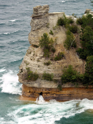
Took a couple of tries to get this one with the water coming through the erosion holes.
Looking West toward Munising:
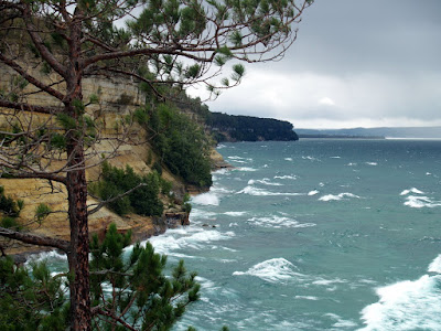
This photo just feels cold to me.
The Castle, up close. The two sides used to match. The right turret fell in April 2006. To see before and after pictures, visit Lake Superior Photo

I noticed the people in the Lake Superior Photo pictures. From what I could see, getting that close is no longer allowed or at least much more difficult. There are many signs that prohibit going beyond the guardrails along the path.
In June of this year, I took the Pictured Rocks Boat Tour, see those pictures here:
Pictured Rocks Slideshow
One more post with pictures of this trip coming soon.
No comments:
Post a Comment